
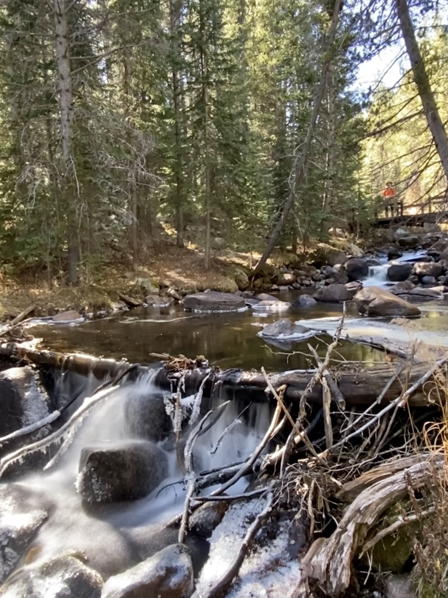
When in the Leadville area, you can find numerous access points for the Colorado Trail, including this easy hike, at the west end of Turquoise Lake, that takes you over three bridges and includes a picturesque creek. The trailhead is popular, so avoid weekends and holidays, or at least arrive early (or late) on those busy days. We did this hike in October, enjoying the fall colors and ice forming along the edges of the creek.
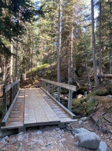
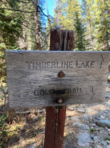
Trail Description: At the trailhead, you’ll find the westbound Colorado Trail starting to the left of the trailhead sign board. Be careful not to start hiking to the right of the sign – that would put you on the Timberline Lake Trail, which is not the CT. The CT isn’t well-marked at first, so once you head left of the sign and start walking, stay to the right and don’t be tempted to walk downhill to the creek. After a tenth of a mile, you’ll reach the first real bridge, over the Lake Fork of the Arkansas River, and you’ll begin to notice CT confidence markers along the trail.
The trail climbs very gently through a healthy pine forest, crosses Glacier Creek, and then drops gently. Very soon after, you’ll arrive at the bridge over Busk Creek, which is a pretty place to rest by the water and take photos. From Busk Creek, the trail climbs uphill to Hagerman Pass Road, where you can turn around or continue uphill along the CT.

Features: There are three bridges across streams on this trail, with each stream a little more beautiful than the previous. The first mile of this trail includes all three bridges and is a gentle beginner level trail so it would be an ideal mini-hike for people with younger children. Also look for the little springs flowing across the trail along the way. While the water is cold, the creeks would be fun for kids to explore and any one of them could become the “destination” if adults or kids run out of energy earlier than expected. On the other hand, if there is energy to spare, add on the uphill hike to Hagerman Pass Road. The climb will burn off that extra energy!
Terrain: Well-maintained single-track with some rocks in the trail.
Difficulty: Easy.
Getting There: From Leadville, take West 6th St. west for about 0.8 miles. Turn right onto County Road 4/McWethy Dr. and drive 2.6 miles to a slight right, where you will continue on County Road 4 for 4.3 more miles. You’ll cross the Turquoise Lake dam and turn right onto Turquoise Lake Road. Two miles from the dam, turn left onto Forest Road 104E and go 350 feet to the trailhead parking lot. The trailhead is well marked as Timberline Lake Trailhead. It is searchable on Google Maps as “Timberline Creek Trailhead.”
Note that the road to Timberline Lake Trailhead is closed at the dam from the “first snow to last snow” (whatever that means!) Once there is snow on the ground, you can still access the road on foot, but it’s about a 2-mile trek on snowshoes or skis to the trailhead, each way.
Parking: There is a parking lot at the well-marked trailhead that can accommodate a couple dozen vehicles. However, during the summer the parking lot is often full during the day. Consider doing this hike in the off-season, or early or late on a weekday.
Length of Hike: 4 miles
Elevation: Trailhead: 10,037. Turnaround: 10,362.
