
While staying in the Telluride or Rico area (or even Dolores or Cortez), you can easily access this hike to the east of Cayton Campground, if you have an SUV or other vehicle with a little clearance. The drive itself is pretty and there are some amazing views to the north. The hike includes a lovely lake at the trailhead and then, as you head to the north and east, you might spot some deer. The trail goes above tree-line but is an easy, gentle uphill with views galore!
Note: we have not attempted access from the Durango/Silverton area, so we can’t speak to the road conditions. But we know that in the summer of 2022 there were road improvements being made. At the Celebration Lake Trailhead we met a couple who had driven from the east side of the pass, from Durango, and were in a Subaru. The drive might take awhile, but it might be work a try.
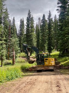
Trail Description: Hike for a short distance through forest and you’ll soon come to a right turn where the trail used to join a jeep road. In 2022 that road was “decommissioned” by the Forest Service, blocked off, and turned into a trail for hikers and bikers only. We were there the day the excavator was dragging logs into the road, compacting a trail, digging drainage, and generally tearing up the old road. While this short 1/2 mile section of the CT will likely take a while to recover and feel like a beautiful trail, hike it thinking of what a peaceful and lovely experience this area will provide in the future.
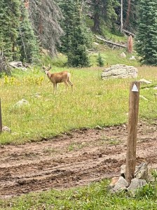
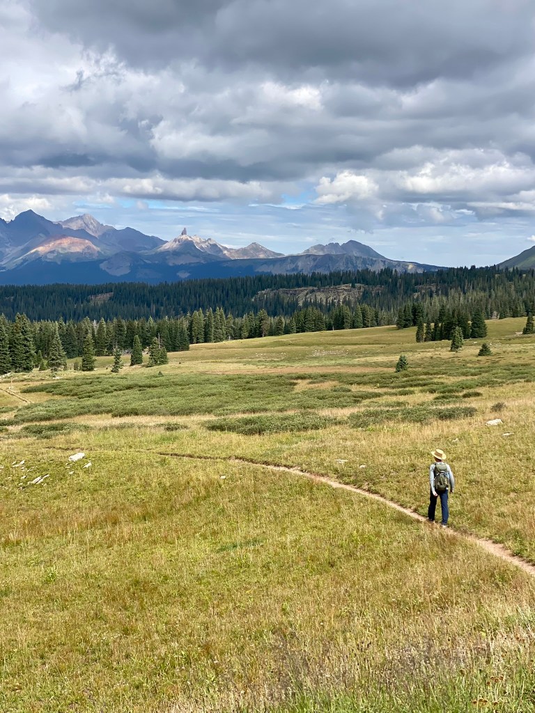
The meadow where the trail joins the old road is where you may find some deer. The deer we saw were not as shy as in other regions – these were more curious and forgiving of our presence.
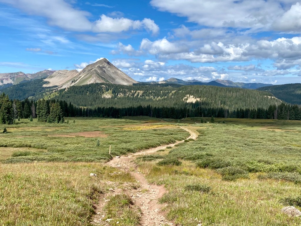
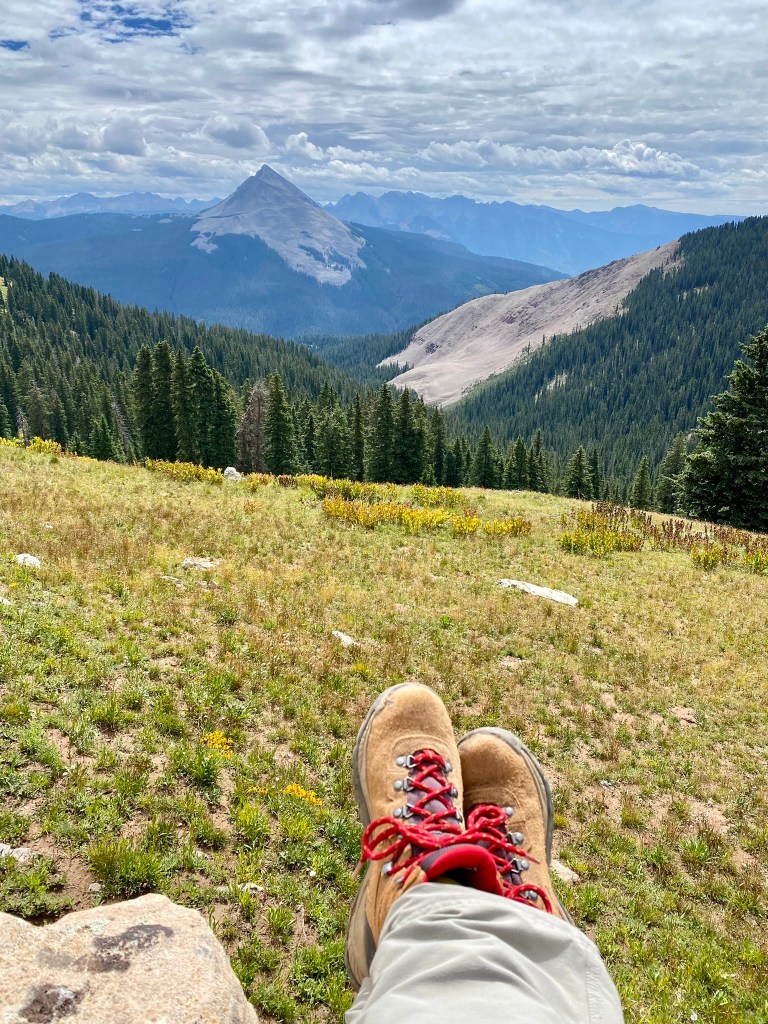
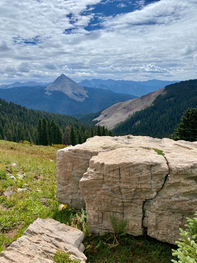
Soon, the trail takes another right turn off the old road to head slowly uphill. You’ll quickly emerge from the forest and begin hiking above tree line, crossing some drainages and admiring the meadows of wildflowers and views. Just keep on hiking until you come around a knob at the high point on this hike. The views ahead of Grizzly Peak and Engineer Mountain are impressive. Note the large white rock up the ridge a little on your left – my choice as the best place to have a picnic on the Colorado Trail. The views are truly 360 degrees of Rocky Mountain heaven. If you don’t mind hiking back uphill, go ahead and hike down to a stream in the trees ahead. The trail continues downhill, so if you decide to continue hiking remember you’ll need the energy to get back uphill at this high elevation.
Features: Views, views, views!
Terrain: A mix of single-track and old, reclaimed road. Not a particularly rocky or challenging trail surface. High alpine.
Difficulty: Easy to intermediate.
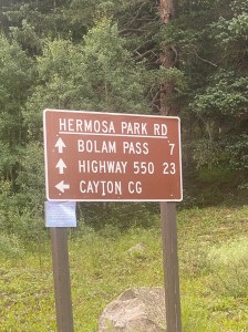
Getting There: From Rico or Telluride via Highway 145: About 6.3 miles north of Rico, or 18 miles south of Telluride, you’ll come to County Road 578 at Cayton Campground. Take 578/Hermosa Park Road eastbound and follow signs for Bolam Pass. At 6.3 miles from the Highway, you’ll get to a fork in the road where you want to take the left fork across a dip, down a drainage. Along the road here are incredible views of a valley across to Lizard Head. You’ll come to Celebration Lake and the trailheads after 7.8 miles.
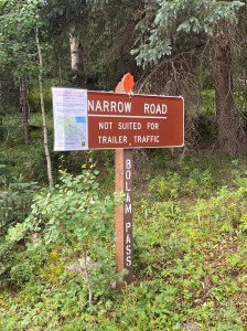
The road was improved in 2022 and, at that time, was easily passable for 4WD vehicles. Subarus and SUVs are fine, but don’t take a Prius or Buick up here. You’ll pass a cute old private cabin and cross several creeks and drainages.
From Durango or Silverton via Highway 550: From Highway 550, take Purgatory Blvd to the west. Turn right onto County Road 578. Stay on County Road 578, passing Sig Creek Campground and driving switchbacks as you get closer to the trailheads. You’ll know you have arrived when you get to Celebration Lake right in front of you with the CT signage just to the left of the lake.

Parking: There is informal space for several cars at the trailhead at Celebration Lake. If, for some reason, you have trouble finding a spot, try driving to the west just past Celebration Lake, where you’ll find a pull out (and campsite) at a lake just uphill from Celebration Lake. Or you can find plenty more parking just east of the Celebration Lake trailhead by backtracking to the west end of Celebration Lake, taking the road that heads east from County Road 578, and driving a few hundred yards to a parking and camping area. You’ll find the trail passes right by the campsites.
Length of Hike: 1.8 miles each way.
Elevation: Trailhead: 11,089. Turnaround: 11,769.
