This trail is a delightful surprise, especially if done on the right day, at the right time of year. It is not far from south metro Denver and is best done in spring or fall when the temperatures are too high.
Trail Description: Start from the parking along Deckers Road (126) and begin hiking the trail on the east side of the road. The CT heads north along Deckers Road for about a quarter mile. You’ll cross Spring Creek Road and Spring Creek Trail (which is a road, not a walking trail). Shortly after Spring Creek Trail, the CT turns east and you’ll see a broad view of the trail ahead, which begins to cross the burn zone from the Buffalo Creek Fire of May 1996.
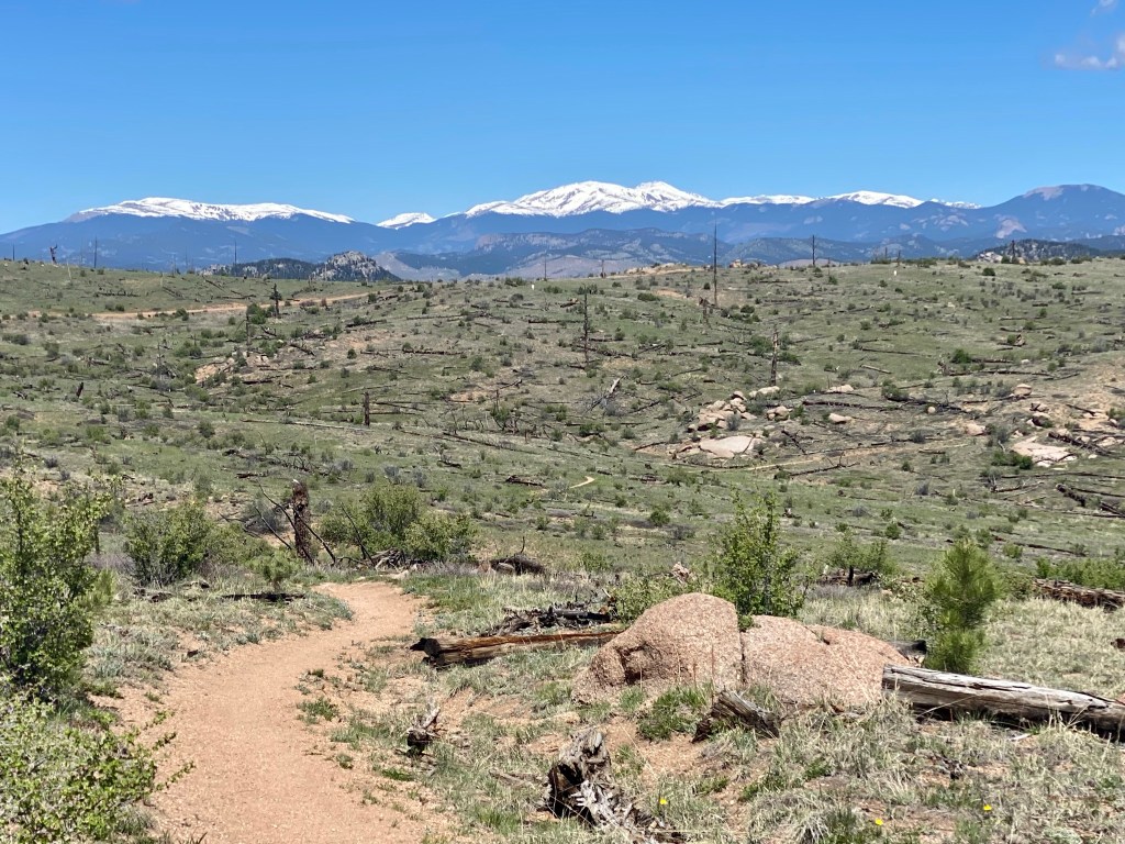
The next three miles of this hike are across the meadows of the burn zone. Enough time has passed that you won’t see much evidence of the fire. While the area is no longer scorched and ashen, the forest was destroyed and left as open meadow with some signs of burnt snags and downed decomposing trees. As a result, in the summer this can be a scorching hike, with no shade until you get to the end of the burn zone, where the forest provides much-needed shade. Keep this in mind when planning your hike – the outbound hike in the morning can feel like no problem, but the hike back in the mid-day sun can challenge even the most experienced hiker. Bring a hat, plenty of water, and wear sunscreen!
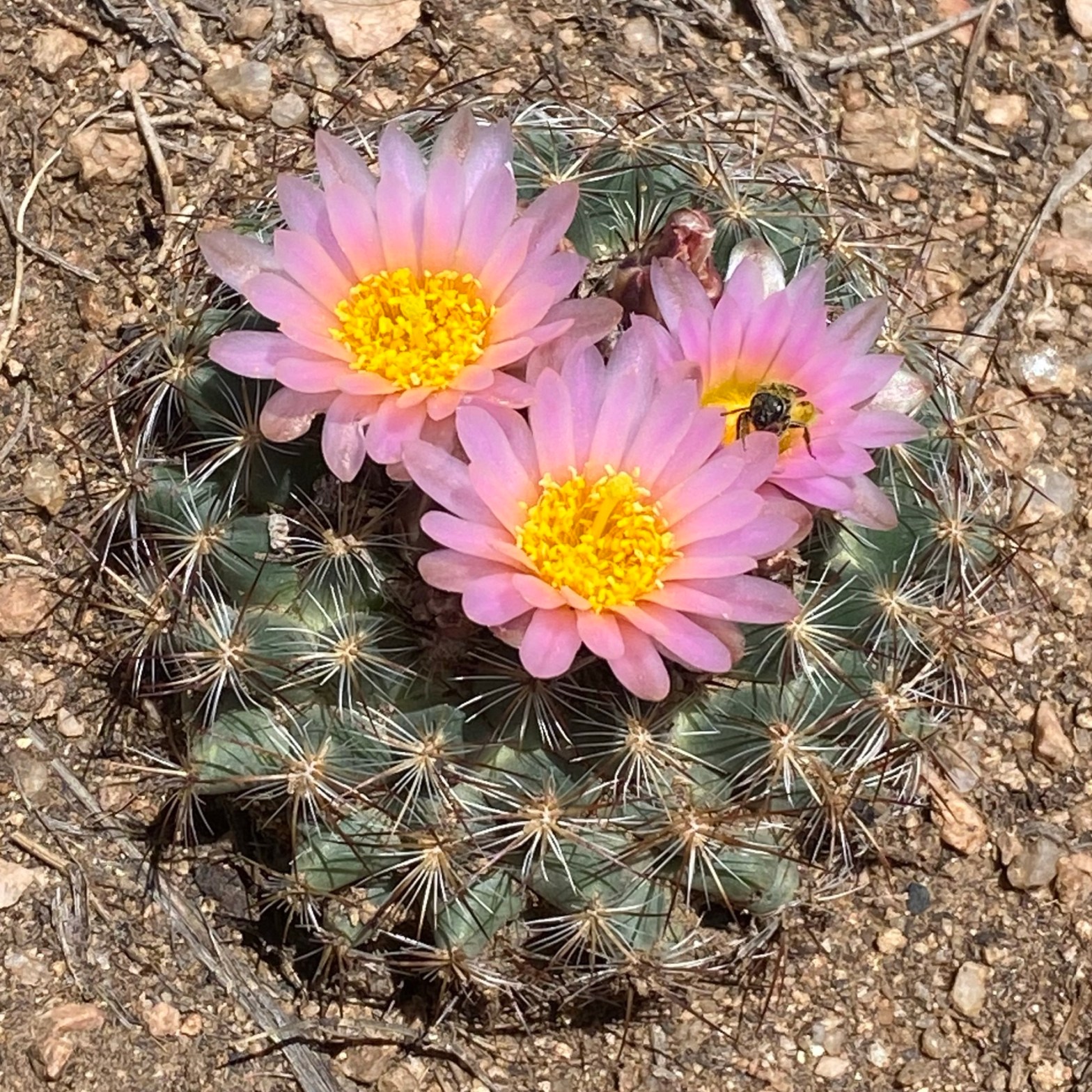
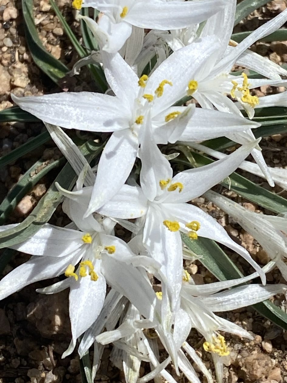
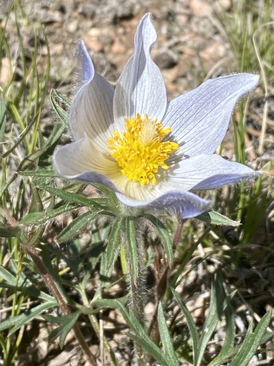
That said, in May wildflowers make this hike worth the effort. Flowering cacti, pasque flowers, white starlilies, and gold peas are just some of the rewards for an early start. The rolling meadows provide grand views on Long Scraggy Mountain, and beyond that to the far southeast you’ll spot Pikes Peak. The hike is relatively flat, with some gentle climbs. As you hike along, you’ll eventually spot a forest service road paralleling the trail on your left. If you find a spot to climb up to the road, you’ll discover more views of mountains to the north and west.

We consider this trail a hidden gem with less traffic than the Buffalo Creek area trails to the west. We did encounter a couple of mountain bikers, but no other hikers on a beautiful May weekday.
Features: Spring wildflowers and grand views including of Pikes Peak.
Terrain: Slow gentle uphill through meadows.
Difficulty: Easy to Moderate depending on how far you go and how hot it is.
Getting There: Between the towns of Conifer and Deckers on Deckers Road.
Parking: Park where the CT meets CR-126/Deckers Road. At this spot there is an old logging road on the west side of CR-126 with a Road Closed barrier across the road. You may find other cars parked along CR-126 here. Be sure to park safely and keep kids and dogs from the highway. Accessible by any vehicle. You’ll start the trail on the east side of the highway, so be careful if you need to cross the road.
Length of Hike: We recommend hiking to where the burn zone ends and you can experience the forest, making this 3.5+ miles each way. If the weather is warm and you don’t want to risk a hot hike back to the car, just hike out a mile or two to see the wildflowers and views.
Elevation: Parking: 7,673. We hiked 4 miles out and had no net elevation change.
