The Colorado Trail passes to the north of Creede, heading west, and then to the south of Lake City. Highway 149 connects these two summer-tourist hotspots, and you’ll find access to the CT at Spring Creek Pass. This hike heads east from the day-use area and is a good uphill workout. The views from the mesa are worth the climb!
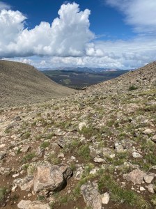
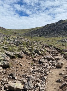
Trail Description: While the Snow Mesa Climb isn’t the most grueling of the Colorado Trail ascents, it is a good high elevation workout. From the designated parking area, head east, across the highway, to easily find the trail heading uphill. You’ll hike through forest, much of it a victim of the spruce beetle. Look for wildflowers and “signs” of deer and moose along the trail. Eventually the trail climbs above tree line and becomes rocky. Just before arriving at the ridge, you’ll climb a dirt path past dramatic scree fields in a beautiful bowl. Once you come over the ridge you can see just how flat and gently rolling the mesa ahead is. You could walk and walk for another three miles before ascending slightly to a knob marking the high point of trail segment 21. The views from the mesa ridge are magnificent. The views walking across the mesa look more like a cow pasture with hills in the distance and you’d almost never know you are in the spectacular Rocky Mountains!
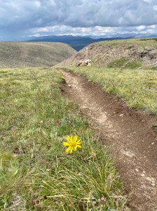
Features: Views and many hard-working pikas in the scree field. Lots of wildflowers thanks to extra sunshine due to the passing of the tall trees. Lots of smaller trees to notice, harbingers of the forest to come.
Terrain: This is a steady climb uphill to the ridge of Snow Mesa. Once on the mesa, the hike is across a flat alpine environment.
Difficulty: Moderate.
Getting There: From Creede, take Hwy 149 westerly for 33 miles to the well-marked trailhead. Spring Creek Pass is a day-use area (no fee) with parking on the west (left) side of the road. The hike is on the east side of the road.

From Lake City, take Hwy 149 southeasterly 17 miles to the Spring Creek Pass Day-use area. Parking is on the west (right) side of the road.
Parking: There are a couple dozen parking places. Get there early (or late) on a weekend if you want your choice of spots. The parking area has toilets and signage.
Length of Hike: 4.3 miles round trip (or more if you continue across the mesa)
Elevation: Trailhead: 10,900. Mesa Ridge: 12,248.
