The Colorado Trail has a symbiotic relationship with some of Colorado’s ski resorts. It comes within view of several resorts, and a couple of resorts provide access to the CT, but at a couple of resorts the CT gets up close. At both Copper Mountain and Monarch Mountain, the trail goes right across the ski runs. In the case of Monarch Mountain, the CT crosses up high – across the top of the ski runs. At Copper Mountain the CT meanders across the bottom of the resort – mostly through the trees and across ski runs. In any case, it’s always fun to visit these areas in the summer when the winter crowds and snow have dissipated.
This day hike starts at the resort and heads west and south, away from the westernmost ski runs.
Trail Description: This is an especially good hike for those vacationing in the area and who are interested in a short hike, a long hike, or an even longer hike.
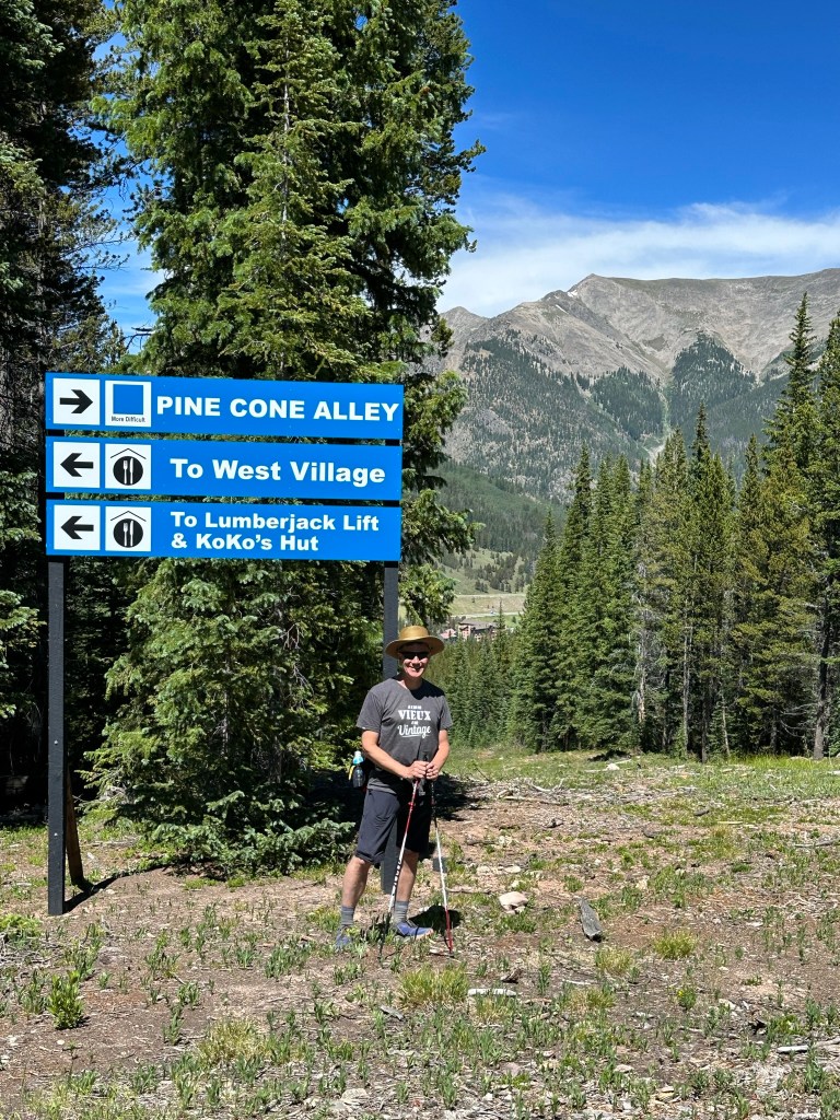
To get to the CT, start at the base of the Woodward Express lift, follow A-Road uphill (westerly). After the first switchback to the east, look for Chickaree Way trail on the right. Hike Chickaree Way uphill through the trees, ¼ mile or so, to the CT.
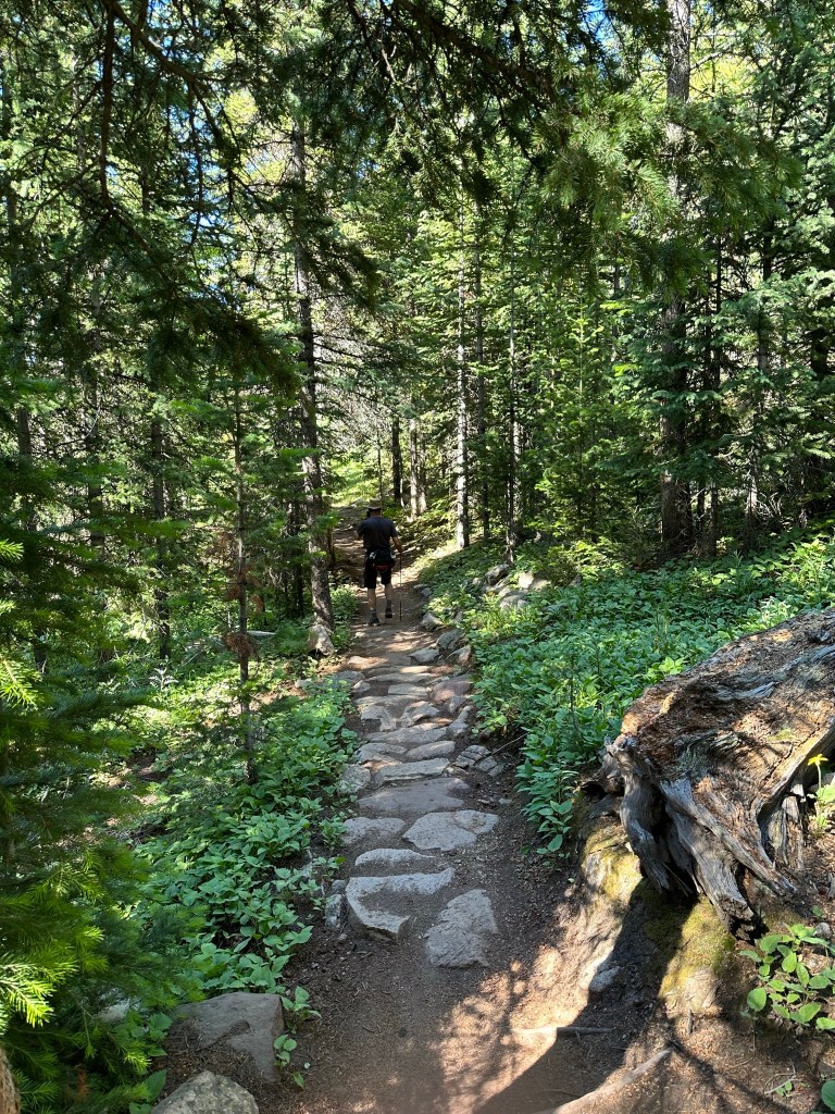
The first two miles of this hike weave through Copper Mountain Ski Resort. Much of the hiking is through the forest between the ski runs. There are other trails for hiking and mountain biking associated with the ski resort (Chickaree and Loose Moose), so be aware of them and don’t get mixed up. Once you’ve crossed West Ten Mile run, you’ll be in the forest and away from the ski area, so traffic on the trail gets lighter and more chill.
Turn right onto the CT to head westerly. We hiked about 2.9 miles from the parking lot to Guller Creek, which is beautiful, and then turned around, making it a 5.8-mile hike round trip. If you want a longer hike, continue to the turnoff to Janet’s Cabin (6.3 miles one-way), or even further, to Searle Pass with its grand views above tree line.
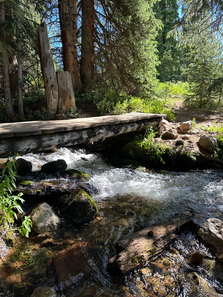
Features: Wildflowers, views, a pretty creek, and the novelty of hiking across ski runs.
Terrain: Most of the trail is single track without a lot of rocks or roots. The ski runs provide some wide-open spaces, but most of the hike is in healthy forest. While there is quite a bit of mountain biking on the trail, there aren’t those deep ruts in the center of the trail that bikes often cut on other parts of the CT.
Difficulty: Moderate. The trail is hard packed dirt, very easy on the feet.
Getting There: I-70 to the Copper Mountain exit (Exit 198) then south towards the resort, turning right into the resort. Drive all the way to the West Village of the resort, where you’ll find parking on the right and left side of the road. The parking lot closest to the trail is at 39.5003, -106.1628 is on the left.
Parking: Free summer parking at West Copper Mountain Village.
Length of Hike: 5.8 miles round trip to Guller Creek. Of course, you can continue on to Janet’s Cabin (about 12.6 miles round trip) or even Searle Pass (about 14 miles round trip).
Elevation: Start: West Copper Village at about 9,750’. Trail Junction at beginning of hike, where you get on the CT: 9,985’. Turnaround at Guller Creek: 10,481’. Searle Pass: 12,044’.
